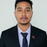

Abdulla Al Nahid is a GIS and Remote Sensing researcher, geospatial analyst, and trainer with a background in Geography and Environmental Studies from the University of Rajshahi. His expertise includes geospatial data processing, spatial analysis, cartography, remote sensing, and GIS-based environmental research.
He has contributed to multidisciplinary research and mapping projects through the Space and Environment Research Center (SERC), the Center for People and Environ (CPE), and the YouthMappers Rajshahi University Chapter, with experience in field data collection, spatial database development, thematic mapping, and geospatial analysis. As a GIS instructor at StatX Academy, he delivers application-oriented training using ArcGIS Pro, enabling students and researchers to apply geospatial technologies in academic research and professional practice